
Hurricane Milton Timeline: As of Sunday afternoon, Milton is still developing in the far western Gulf. It will intensify rapidly as it moves across record-hot Gulf water.
The core will reach Florida’s West Coast by Wednesday as a likely major Category 3 storm. But impacts will be felt before the eye crosses the coast.
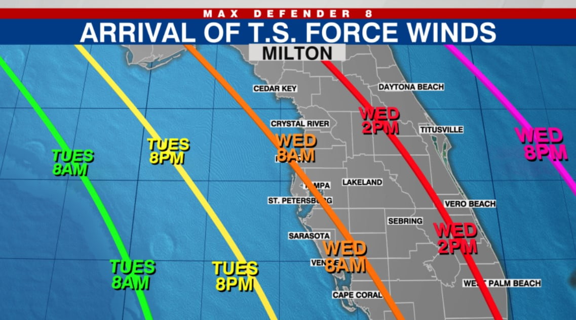
In the Tampa Bay Area coastal zones, expect that tropical storm force winds will arrive around sunrise Wednesday, give or take. They will arrive first south of Tampa Bay and then later morning north and east of Tampa Bay. Use the graphic below as a guide.
Hurricane Milton Timeline
As of now, landfall of the storm’s center is expected around early afternoon, but that may vary by 6-12 hours either way. So any preparations need to be complete by Tuesday before nightfall.
Assuming this timeline holds, hurricane force winds — close to the center of Milton — can be expected by late morning along the coastal areas of Tampa Bay and early afternoon inland. Again the strongest winds will arrive slightly earlier for areas south of Tampa Bay and slightly later north and east.
Since the track has been changing, and will continue to shift for another day, we are not exactly sure who will see the strongest winds. By Monday the forecast will be much more certain.
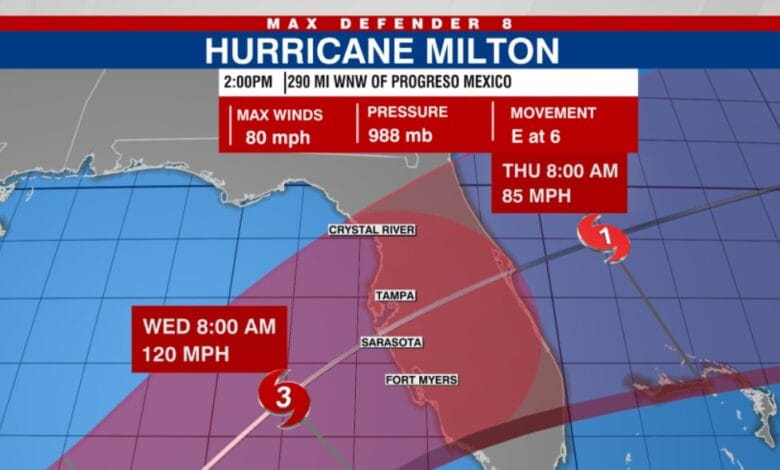
Below is the 2 p.m. National Hurricane Center advisory and 11 a.m. forecast track, which is the most recent track issued. The next track update will be at 5 p.m.